North Dakota Spring Frost Timing and Regional Freeze Normals
North Dakota gardeners often want a single spring planting date, but frost risk does not move across the state on one calendar day. Regional freeze normals offer a useful starting point, not a guarantee. Here’s how to read the station data, use it to organize planting, and adjust your plans for your yard’s conditions and the forecast.
What North Dakota’s spring freeze normals show
A spring freeze normal is a reference point for when freezing temperatures have typically occurred at a weather station. It can help you compare the broad timing of spring risk in different parts of North Dakota, but it cannot promise that your garden will be frost-free on that date.
According to NOAA National Centers for Environmental Information, at the Fargo Hector International Airport weather station in North Dakota, the 1991–2020 normal last spring freeze (32°F) at 50% probability is 05/10 (May 10).
According to NOAA National Centers for Environmental Information, at the Bismarck weather station in North Dakota, the 1991–2020 normal last spring freeze (32°F) at 50% probability is 05/14 (May 14).
According to NOAA National Centers for Environmental Information, at the Williston Sloulin International Airport weather station in North Dakota, the 1991–2020 normal last spring freeze (32°F) at 50% probability is 05/21 (May 21).
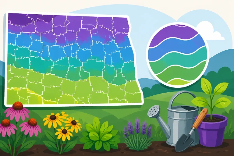
Taken together, these station records show why a statewide date is a poor substitute for local planning. The Fargo and Bismarck normals fall earlier than the Williston normal, while Bismarck’s falls between the other two. The comparison describes the stations, not every garden in the regions around them. A yard may warm sooner or remain colder than a nearby station, depending on its setting and the weather at the time.
| Station | Relative timing shown by its normal | Practical use |
|---|---|---|
| Fargo Hector International Airport | Earlier than the Bismarck and Williston station normals | A regional planning reference for gardeners comparing timing around Fargo |
| Bismarck | Between the Fargo and Williston station normals | A central reference point, not a date that applies to every nearby yard |
| Williston Sloulin International Airport | Later than the Fargo and Bismarck station normals | A reminder that spring freeze risk can persist later in western North Dakota |
The table is a comparison of the named weather stations. It does not establish a freeze date for any particular town, ZIP code, or property. Gardeners elsewhere in the state can use the closest station as a broad reference, then consider their own conditions and follow local forecasts.
These dates can be useful alongside North Dakota Spring Frost Timing and Regional Freeze Normals, which addresses regional timing, and Average Spring and Fall Freeze Dates Across North Dakota, which offers another way to compare seasonal freeze patterns. For the planting calendar itself, see When to Plant Spring Vegetables Outdoors in North Dakota.
How to interpret a 50% probability date
A 50% probability date is a midpoint-style planning reference, not a safety cutoff. It describes the chance associated with the normal for that station. It does not mean freezing conditions cannot occur later, and it does not guarantee that every garden will experience a freeze by then.
That distinction matters because a date can look reassuring on a calendar even while a cold night remains possible. If a gardener treats the normal as a promise, tender plants may go outside too soon, or seedlings may be left without protection when the forecast turns colder. The practical reading is more cautious: the station normal helps frame the season, while the forecast and the yard’s conditions guide the immediate decision.
The probability applies to the station record, not to a specific garden bed. A weather station represents its own location and measurement history. Your garden may differ because it sits in a low spot, catches wind, receives shelter from buildings, or is exposed to open sky. Those features can affect how cold plants become at night, even when the wider area shares the same forecast.
A normal also smooths out variation between seasons. Spring weather can arrive gradually or swing between mild afternoons and cold nights. The normal summarizes a long period of observations; it does not tell you what the next week will bring. That is why the number is best used for preparation rather than as a trigger to plant every crop.
Think of the station date as a checkpoint in your planning:
- Before it, assume that frost protection may still be needed for tender plants.
- Around it, use the forecast and your garden’s exposure to decide whether to plant, wait, or protect.
- After it, continue monitoring conditions rather than assuming the risk has ended.
These are decision habits, not guarantees about what weather will occur. A forecast can change, and a local cold pocket can behave differently from the station. If a freeze-sensitive crop is important to you, a little patience or temporary protection can be more useful than treating the normal as a promise.
For a deeper look at the distinction between a freeze-free period and a station date, see North Dakota Freeze-Free Growing Seasons and Frost Normals. If your schedule needs to account for different parts of the season, North Dakota Freeze Dates and Seasonal Planting Schedule can help connect freeze timing with broader planting decisions.
Turn the station reference into a planting plan
A planting calendar works best when it separates crops by their tolerance for cold and by how easily they can be protected. It is less useful as a single list of dates that assumes all seeds and transplants should go into the ground together.
Start by sorting what you plan to grow into broad groups: crops that tolerate cool conditions, crops that need warmer soil or air, and tender transplants that can be damaged by frost. This does not require an elaborate spreadsheet. A short list on paper is enough to show which plants can go in early and which should wait for a safer forecast.
Cool-season seeds and starts can often be considered before tender crops, but readiness depends on more than the air temperature. Soil that is cold, wet, or difficult to work can slow establishment. A calendar date alone cannot tell you whether the bed is ready. Check that the soil can be worked without smearing or packing, and pay attention to the conditions each crop needs.
Tender crops deserve a more cautious approach. Tomatoes and peppers, for example, are common garden plants that many people start indoors or buy as transplants. Their presence in a garden center does not mean the outdoor conditions are suitable. A plant that has spent its life in a protected setting may need gradual adjustment to sunlight, wind, and outdoor temperature before it is planted. The station normal helps you anticipate the season; it does not replace that transition.
A practical planting sequence might look like this:
- Prepare beds and gather supplies while using the station normal as a reminder that freezing weather can still be part of spring.
- Sow or plant cool-tolerant crops when the soil and conditions suit them.
- Keep tender starts protected while cold nights remain in the forecast.
- Acclimate indoor-grown plants gradually before leaving them outdoors.
- Plant tender crops only when the current outlook and the garden’s conditions make the risk acceptable.
- Keep a cover or another suitable protection method ready when a late cold forecast appears.
This is a flexible sequence, not a fixed schedule. The timing shifts with the part of the state, the season’s weather, and the conditions of the individual garden. How Spring Planting Dates Shift Across North Dakota Regions discusses why regional timing deserves more attention than a single statewide calendar.
If you are deciding whether to sow directly or grow transplants, the method also affects how much control you have. Direct-sown seeds avoid the shock of moving a plant, but they depend on suitable soil and weather at the bed. Indoor starts give you a head start on growth, but they need careful acclimation and protection after moving outside. For a more detailed comparison, see Which Crops to Direct Sow vs Start Indoors for Prairie Beds and Direct Sowing vs. Starting Transplants for North Dakota Gardens.
Starting seeds indoors does not eliminate spring frost risk. It changes where the early growth happens and gives you a plant to manage when outdoor conditions are still unsettled. If seedlings are moved out too quickly, wind and sun can stress them even when there is no freeze. Hardening Off Young Starts Before North Dakota Spring Frosts explains how to make that transition more gradually.
Another useful option is to plant in stages rather than committing the whole garden at once. You might sow a first group of suitable crops, wait to see how conditions develop, and then continue with tender crops. That approach spreads the risk and gives you room to learn how your garden responds. Succession Planting in North Dakota for Steady Harvests covers how repeated sowing can support a longer harvest.
Why your yard may not match the nearest station
A station normal is a regional clue, not a miniature map of every garden. Even nearby yards can experience different conditions. Before using a station’s normal to make a planting decision, look at how your site handles cold nights.
Low areas are worth watching because cold air can settle in hollows or other sheltered depressions. A bed at the bottom of a slope may stay colder than a nearby bed higher up. A garden beside a wall or fence may be sheltered from wind, while an open plot may be more exposed. Trees and buildings can also alter how much sky a spot sees at night. These differences are not a precise formula for a new freeze date; they are reasons to observe your own yard instead of assuming a station describes it exactly.
Pay attention to patterns over time. Which areas are last to thaw in the morning? Where do frost-sensitive plants show damage first? Does one bed dry or warm more slowly than another? These observations can help you decide where to place early crops and which plants need protection. They are especially useful when you are comparing two locations in the same garden.
A simple yard map can make those observations easier to use. Mark the beds that receive shelter, the open or wind-exposed edges, and any low spots. Note where you have planted tender crops and whether the forecasted cold nights have caused problems there. The map does not need to be exact. Its purpose is to help you make consistent choices instead of relying on memory or assuming that every bed shares the same conditions.
Microclimate is not a guarantee of warmth. A sheltered spot may escape some wind but still experience cold air. A sunny wall can warm during the day without keeping nearby plants safe through the night. Treat these features as clues to compare, not as permission to ignore a freeze forecast.
When your garden sits far from a named station, use the station date for broad context and then rely more heavily on the local forecast and your own observations. Avoid transferring a station’s exact normal to a different city or assigning it to a specific address. The station data are valuable because they reveal regional differences, but the forecast is more relevant to an immediate decision.
For gardeners whose sites have noticeable warm or cold pockets, Mapping Microclimates and Warmer Zone 4b Spots in North Dakota offers more detail on observing local variation. Its focus is broader than frost alone, but the same habit applies: compare real conditions in your yard rather than relying only on a map or regional average.
Use forecasts and protection when cold returns
Seasonal normals help with long-range planning. Forecasts help with the near-term decision. When a cold night is predicted, consider the forecast for your location, the plant’s sensitivity, and whether you can protect it. The normal date does not override a current warning or a cold forecast.
Protection is most effective when it is ready before the evening turns cold. Keep suitable covers on hand, know which plants are most vulnerable, and make it easy to cover them without rushing. A lightweight cover can reduce exposure for plants beneath it, but the material and setup matter. Follow instructions for any product you use, and avoid assuming that one method works equally well in every weather condition.
Check that a cover is secure enough not to blow away and that it protects the plants rather than pressing heavily on delicate growth. If plants are in containers, moving them to a sheltered location may be an option, provided the location is appropriate for the plant. Do not leave covered plants unattended through warming conditions without checking them; covers may need to be managed as weather changes.
Different protection approaches come with trade-offs. A cover can be quick to deploy, but it requires monitoring and may need adjustment. Moving a pot can be straightforward, but it is practical only for portable plants and suitable shelter. Waiting to plant is the simplest way to avoid exposing a tender transplant to a risky night, though it can delay the start of its outdoor growth.
| Situation | Practical response | Main trade-off |
|---|---|---|
| A tender plant is still indoors | Keep it protected and wait for suitable outdoor conditions | Waiting can shift the planting schedule |
| A transplant has just moved outside | Monitor the forecast and cover or shelter it when appropriate | Protection requires preparation and attention |
| A cold night is forecast for an exposed bed | Prioritize vulnerable plants and use suitable protection | Open, windy locations can make protection harder |
| Conditions vary across the yard | Protect the most vulnerable areas first and compare outcomes | Different beds may need different decisions |
| The forecast is uncertain | Keep supplies ready and avoid treating the normal as a guarantee | You may need to make a decision as conditions update |
The table is a planning aid, not a promise that a particular cover or location will prevent damage. The best approach depends on the plant, the expected conditions, and how well the protection can be used. For more on shielding plants from a sudden cold night, see Covering Tender Crops Before North Dakota Nighttime Freezes and Using Lightweight Row Covers to Prevent Early Frost Injury.
Wind can complicate protection, especially for newly planted starts. A plant may face exposure even when temperatures do not reach freezing. If your garden is open to strong prairie winds, consider how wind exposure affects the placement and support of covers, as well as the plants’ gradual adjustment to the outdoors. Protecting Spring Transplants from Cold Prairie Winds focuses on that challenge.
Do not rely on a normal to decide when to remove every protective measure for the season. Keep monitoring forecasts for the plants that remain sensitive to cold. If a garden has a history of frost pockets, keep that location in mind even after other beds seem to be past the highest-risk period. Tracking Frost Forecasts to Protect Late-Season Garden Harvests addresses forecast monitoring later in the season, but the same basic habit of checking conditions is useful in spring.
Build a calendar that can change with the weather
A useful calendar is not a promise to plant on a particular day. It is a structure for preparing at the right time and changing course when conditions do not cooperate. Write down the station normal you are using, but mark it as a reference rather than a deadline. Alongside it, keep notes about soil readiness, the forecast, and the behavior of your yard’s warmer and colder spots.
A calendar can include tasks instead of fixed planting dates. For example, prepare beds, check seed packets, sort crops by cold tolerance, bring covers within reach, and begin acclimating seedlings when conditions permit. Those tasks keep the season moving even when it is too cold to plant a tender crop outdoors.
Try to keep separate notes for sowing, transplanting, and protection. They are related decisions, but they do not have to happen together. Seeds may be suitable for sowing when transplants still need shelter. A transplant may be ready to go outside after acclimation while the forecast still calls for protection at night. A single “planting day” can hide those differences.
It also helps to distinguish a plan from a backup plan. For each tender crop, decide what you will do if a cold night is forecast: wait, move a container, or protect a plant already in the ground. That choice is easier to make before the weather turns than during a rushed evening. If the forecast changes, adjust the plan without assuming that the calendar has failed. The weather is variable; a flexible calendar is built to accommodate that.
Keep the station reference relevant to where you garden. The Fargo, Bismarck, and Williston normals show a regional spread, but gardeners beyond those stations should not assume that one of them precisely represents their location. Choose the nearest useful regional reference, consult local forecasts, and note how your garden differs. If the site is especially exposed or sits in a cold pocket, give those observations real weight.
Finally, review your notes after the growing season. Record when tender plants went outside, whether a cold forecast occurred, which locations needed protection, and which methods were manageable. Do not treat one season as a replacement for a normal. Instead, use your observations to refine the next year’s plan while keeping the station data and weather forecast in view.
For a more complete calendar that links sowing, transplanting, and seasonal timing, see North Dakota Indoor Seed-Starting: Planning by Spring Frost Dates and North Dakota Freeze Dates and Seasonal Planting Schedule. If you are choosing plants for a shorter or colder site, Selecting Cold-Hardy Plants for Zone 3 and Zone 4 Gardens can help with the broader question of what is suited to a northern garden.
Common mistakes when using spring freeze normals
One common mistake is treating a 50% probability date as the end of frost risk. The date is a planning reference, not a promise. A tender plant can still face cold weather after the normal, so keep checking forecasts and have a protection plan for vulnerable crops.
Another mistake is applying one station’s date across the entire state. The three station normals are not identical, and none describes every garden. Use a station as a broad point of comparison, not as a universal planting instruction. If your location differs from the station in exposure or landscape, account for that too.
A third mistake is planting every crop at once. Different crops have different cold needs, and seeds, established plants, and recently transplanted seedlings do not all respond to conditions in the same way. Staggering tasks lets you use suitable weather for the crops that can handle it while holding back tender plants.
It is also easy to confuse a favorable afternoon with a safe night. A warm day can make outdoor planting feel timely, but the overnight forecast matters for tender plants. Check expected low temperatures and local advisories before leaving vulnerable plants exposed.
Finally, avoid treating protection as automatic insurance. A cover, sheltered spot, or portable container can help, but each has limits. Choose a method you can deploy correctly and monitor as conditions change. When the forecast is uncertain and the plant is sensitive, delaying the move outdoors may be the more dependable choice.
Frequently Asked Questions
Does the Bismarck normal apply to every garden in central North Dakota?
No. It is a reference for the named weather station, not a guaranteed date for every location. Use it alongside your local forecast and observations of your own yard.
If my area is past its normal date, can I stop checking for frost?
No. A normal is not a guarantee that freezing weather has ended. Keep checking forecasts when tender plants are outdoors, especially if your garden has cold or exposed areas.
Should I plant everything on the date for the nearest station?
No. Crop needs, soil conditions, acclimation, and the immediate forecast all matter. Use the station normal to help organize your plans, then make separate decisions for cool-tolerant crops and tender plants.
What if my garden is far from Fargo, Bismarck, or Williston?
Treat the station data as regional context rather than as a precise local date. Consider the nearest useful station reference, consult local forecasts, and observe whether your garden tends to be colder or warmer than surrounding areas.
Sources
- NOAA National Centers for Environmental Information — NOAA NCEI 1991–2020 Climate Normals — Fargo Hector International Airport, North Dakota (checked November 14, 2026)
- NOAA National Centers for Environmental Information — NOAA NCEI 1991–2020 Climate Normals — Bismarck, North Dakota (checked November 14, 2026)
- NOAA National Centers for Environmental Information — NOAA NCEI 1991–2020 Climate Normals — Williston Sloulin International Airport, North Dakota (checked November 14, 2026)
Disclaimer
This article is for general informational purposes only and does not constitute professional advice. Laws, prices and regulations vary by location and change over time. Consult a qualified professional for guidance on your specific situation. North Dakota Gardening Guide is not a government agency and is not affiliated with any university extension, state department of agriculture or other government agency.